Liz Bonnin introduces a short film explaining the techniques used on Hayling Island to control coastal erosion.
LIZ BONNIN: Hi, I'm Liz Bonnin. Here at the Burning Gap, in East Sussex, coastal erosion is a really big deal. This row of houses has been getting shorter and shorter for the last 100 years. There used to be seven, and now there are only four left.
Erosion is something anyone studying physical geography is going to have to get to grips with. This next clip shows how some areas are particularly vulnerable to coastal erosion.
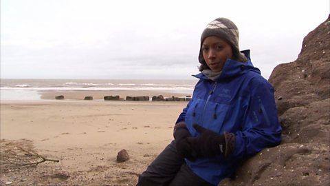
And it looks at some of the interesting measures people take to monitor it, and protect local homes. Let's join Ellie Harrison on the beach at Hayling Island, near Chichester, in Hampshire.
ELLIE HARRISON: This is Hayling Island, just near Portsmouth, and it's a hotspot for beach combing.
Although I haven't found anything yet. Perhaps I should have pulled out the big guns. Check out the size of this detector. Sacha, yours is definitely bigger than mine. Let's see it in action.
Sacha Neil is a coastal engineer from the Eastern Solent Coastal Partnership, but she's not beach combing, she's beach scanning.
What are you actually doing with this kit?
SACHA NEIL: So I'm not looking for treasure like you, Ellie, I'm actually collecting data from a number of different tracer pebbles that were deployed at various locations along this frontage.
ELLIE HARRISON: Tracer pebbles? That's interesting.
Tracer pebbles are an ingenious way to study the movement of shingle along the beach. Hayling Island has battled with coastal erosion and flooding for decades. During storm Brian in 2017, around 15 metres of sea wall was lost. But data from these special pebbles is providing vital information to help manage the coastline.
These are our tracer pebbles then?
SACHA NEIL: This is them, yeah.
ELLIE HARRISON: How does it all work?
SACHA NEIL: Well the technology's no different to that that you'd find in a store. The barcode on clothes, or security tags. And all it is, is this tiny little glass tag really.
ELLIE HARRISON: Yeah.
SACHA NEIL: And this stores an ID number. So we then place the tags inside the pebbles, and the scanner's able to read the number, and that saves it and we're able to monitor that as it moves along the beach.
ELLIE HARRISON: So I'm guessing the challenge is how you put a tag inside a pebble?
SACHA NEIL: It is, yes. Well first of all we have the problem of drilling it. And what we've ended up doing is, we send it to a local company who water-jet them. So we get this really nice clean drilled hole. Then we use a bit of resin putty, and then it's simply a case of plugging the hole with the tag. We seal the hole, and this is a water-proof resin so it will go hard. So we let it dry. And that's our pebble.
ELLIE HARRISON: And then once that's been done, what's the process after that? Once it's dried and it's looking like a pebble again.
SACHA NEIL: We then weigh and we measure them all. We give them all a number as well. This gets logged on to a database that we store, so we know exactly how big each pebble is and what its number is.
ELLIE HARRISON: And what has the data shown?
SACHA NEIL: For us along here, what we found - which is quite important - is that material comes ashore further along the beach and then we're finding that almost two-thirds of the material is moving west, towards this end of the beach, and almost a third is going east towards the other end.
ELLIE HARRISON: That information allows the team to recycle material from either end of the beach to build back up any of the eroded areas, restoring the beach's natural defence against the sea. Now it's time to place some of the tracer pebbles.
There we go. See how far that goes.
SACHA NEIL: Beautiful! [LAUGHS]
ELLIE HARRISON: So we just sort of chuck it somewhere or? What's the next stage?
SACHA NEIL: Place it. We'll place it on the beach.
ELLIE HARRISON: Place it nicely.
SACHA NEIL: Place it nicely [LAUGHS].
ELLIE HARRISON: So where would you put them?
SACHA NEIL: If we try and get them in the middle of the beach, maybe about halfway down.
ELLIE HARRISON: And then just literally, ba-donk, down they go?
SACHA NEIL: Just put them on the beach, yeah.
**ELLIE HARRISON: IncludingтІ Are you doing the test? I'm sure they're there.
SACHA NEIL:** And then we'll scan the pebbles here. And it's picked them up, it's detected so we've now got a baseline position to work to when we find them again.
ELLIE HARRISON: And then you just walk away?
SACHA NEIL: We walk away.
ELLIE HARRISON: Let them roll their own way.
SACHA NEIL: Let the sea do its job, yeah.
ELLIE HARRISON: Alright.
Monitoring the movement of the shingle in this way is deemed a soft defence, but some areas of Hayling Island are more vulnerable to the elements, needing what's called hard defences. Dr Samantha Cope is also part of the coastal partnership trying to deal with the complexities of the beach here on Hayling Island.
It looks quite a bit different up here with these big rocks, is this a different approach?
DR SAMANTHA COPE: Yeah so this section through here is more vulnerable to hinging back, what with the entrance of Chichester Harbour and the focusing onshore waves. And just behind us we have a flood route that will feed through to flooding the houses, which is why we put the rock in place.
ELLIE HARRISON: And if there was no beach management at all if we simply left the sea to do what it would do, what would happen here?
DR SAMANTHA COPE: Yeah so the beach would very quickly erode, move in to Chichester Harbour and up towards the west of Hayling Island. And that would then put these 1700 properties behind us at risk of flooding.
ELLIE HARRISON: So it's quite important that the hand of man has to intervene I suppose.
DR SAMANTHA COPE: Yeah and this allows us to continue to work with nature and with the coastal processes.
ELLIE HARRISON: Well my pebble hasn't moved that far yet, but where will it turn up in 20 years from now?
LIZ BONNIN: I haven't got a tracer, but it does make you think. I wonder where this pebble is going to end up.
Liz Bonnin introduces the significance of coastal erosion by highlighting how many houses have been lost to the sea.
This short film explains some of the inventive methods used to attempt to combat coastal erosion on Hayling Island in Hampshire - particularly tracer pebbles to measure the movement of shingle along the beach.
The clip explains how the information from sediment movement is then used to ensure soft engineering coastal management techniques are effective in restoring the beaches natural defences against the sea.
Hard engineering techniques are also used on Hayling Island and the clip explains how and why these techniques are used - to stop the flooding of large areas of Hampshire.
This short film is from the ТщЖЙдМХФ series, Physical Geography with Liz Bonnin.
Teacher Notes
Key Stage 3
This short film would serve as a good introduction to coastal management techniques for students - showing the difference between hard and soft techniques.
It also introduces the idea of using technology in monitoring coastlines which could be further explored with research or consideration of data from tracer pebbles.
Key Stage 4
This short film focuses on the use of technology in the monitoring of coastal erosion and thus could be used to consider how technology increasingly helps our understanding of risk and processes.
This could be explored further with research or use of GIS to look at some sediment movement data.
Curriculum Notes
This topic appears in geography at KS3 and KS4 / GCSE in England, Wales and Northern Ireland and National 4/5 in Scotland.
More geography clips with Liz Bonnin:
What is the water cycle? video
Iain Stewart describes the water cycle and explains that water is constantly suspended in the atmosphere, yet we only notice it when it falls as rain.
How does a river change as it travels downstream? video
Liz Bonnin introduces a ТщЖЙдМХФ archive clip of Sir David Attenborough as he follows the Amazon River downstream.
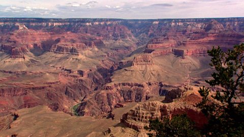
The erosion of the Grand Canyon. video
Liz Bonnin introduces the Grand Canyon with its complex and very ancient geology.
What is a тspitт and how does it form through longshore drift? video
Presenter Katie Knapman explains how a spit forms through longshore drift and is a dynamic feature- constantly changing the coastline.
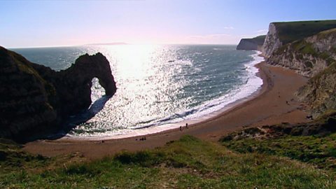
The geological significance of the Jurassic Coast. video
A look at the Jurassic coastline and its geological significance with rocks spanning the Cretaceous, Jurassic and Triassic periods.
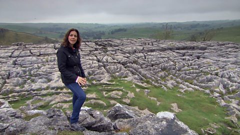
How has ice and other processes impacted the landscape of Yorkshire? video
Wildlife presenter Julia Bradbury explains how Malham Cove and the limestone pavement formed, highlighting the significance of glaciers on the landscape.
What does the North Norfolk coastline tell us about how glaciation shaped Britain? video
Presenter and biologist Alice Roberts explains how Britain used to be connected to Europe via a land-bridge but has changed with sea-level rise since the last Ice Age.
Glaciation of the Northern Hemisphere. video
Presenter Iain Stewart explains the glaciation of the Northern Hemisphere, looking at the El Capitan rock face.
What evidence is there for a changing climate in the UK? video
Countryfile presenter Tom Heap introduces the idea that the UK climate might be changing, with increased droughts, increased summer temperatures but wetter winters.
The continued impact of plate tectonics on our oceans. video
A look at how our oceans are constantly changing due to the underlying plate tectonics.
What can Anglesey tell us about the plate tectonics of Britain? video
Presenter Nick Crane uses a map to compare the geology of Anglesey to that of the rest of Britain - highlighting the diversity of rock types.
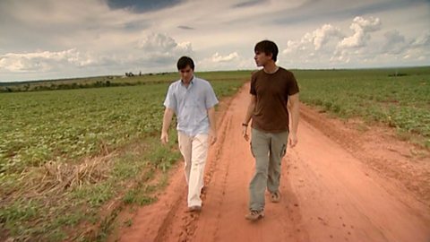
Deforestation and soya growth in Paraguay. video
Simon Reeves visits Paraguay to consider the deforestation that has occurred to grow soy and the challenge of conversation vs exploitation.