Canals used to be very important for transport in Scotland. They were used for carrying raw materials, other freight and even people.
Other transport routes are now used much more, but canals are still used for travel and leisure.
Key points
In this article you can find out:
- what canals are
- the history of canals in Scotland
- how canals are used for tourism
- parts of Scotland's transport network
This resource is suitable for People, Place and Environment topics for P5, P6 and P7 (Second Level Curriculum for Excellence).
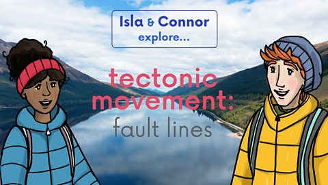
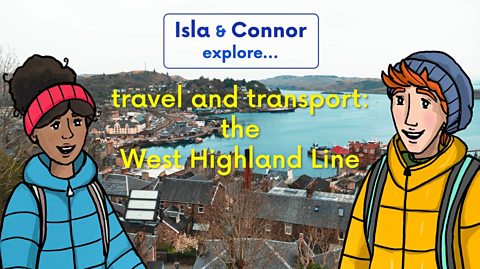
Watch
Watch as Isla and Connor explore the Forth and Clyde canal on their bikes!
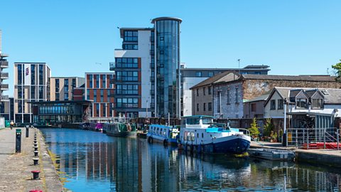
CONNOR: Bowling Harbour here on the River Clyde is where our trip along the Forth and Clyde Canal starts.
The canal creates a route right across Scotland from the Irish Sea in the west to the North Sea in the East, linking up the Clyde and Forth rivers.
ISLA: Isn't the Forth and Clyde Canal impressive?
It was built between 1768 and 1790 when roads were often poor - and before railways, canals were an easier way to transport things like food, coal iron, and cloth.
They're artificial waterways.
A bit like rivers but built by people.
That must have saved a lot of time for goods being transported by boat.
They no longer had to go all the way round the North coast of Scotland just to get to the other side of the country.
CONNOR: Look at the old swing bridge here, it used to carry trains over the canal before this railway was abandoned.
Disused old railways like this make great cycling and walking routes because they're flat, just like the path along the canal.
ISLA: That's Old Kilpatrick where there used to be a Roman fort.
The Romans built a defensive wall here called the Antonine Wall because the land here betweenthe River Clyde and River Forth is narrow which meant a shorter distance to defend.
CONNOR: The canal was built here for the same reason.
It's the narrowest part of the country, so it's a shorter journey.
ISLA: Yes, so this has been an important route for centuries, spanning the country for defence and for trade.
CONNOR: There's still so much to see.
Come on!
These are locks, Isla.
ISLA: Oh Yes. Canals are flat so they have locks like this to go up or downhill.
CONNOR: When a lock's gate is open the water on either side is at the same level and a boat can pass into the lock.
This gate can be closed and the next gate opened, letting water in and filling the lock.
Once the boat has been lifted up to the next level it can sail out of the lock and carry on its journey.
Locks are like stairs for boats.
There is another kind of lock further up the canal, too.
Here we are, look.
ISLA: Incredible.
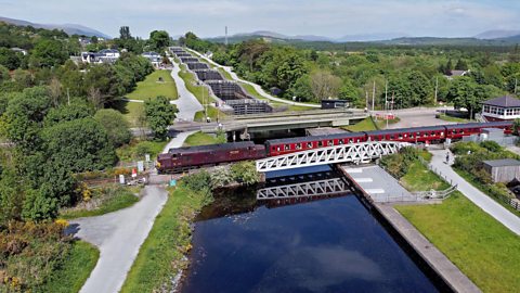
Is this the Falkirk Wheel?
CONNOR: Yeah.
There used to be a series of eleven locks here that joined the Forth and Clyde Canal to the Union Canal, 35 metres higher up.
It took a long time to get through them all.
But now the wheel replaces some of those locks.
There are two troughs of water, one on either side of the wheel.
When one is lowered the opposite one rises up.
It's like a lift for boats.
Both sides weigh the same and balance out.
So the wheel only uses a tiny amount of energy.
ISLA: The Falkirk Wheel helps connect communities by water.
And now it's a huge tourist attraction too, bringing people here to Falkirk.
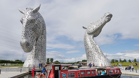
Oh, wow.
The Kelpies sculpture, aren't they stunning.
We're at the end of our journey now at the Helix Park, the park was created by improving and connecting existing paths and walking routes through woodland, grassland and along the canal.
CONNOR: Look at all the different ways we've seen to connect communities.
Canals, bridges, paths, cycle networks old railways, and not to mention impressive engineering like The Falkirk Wheel.
The M9, a big road, is nearby too, all of them joining people and places to one another.
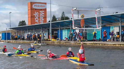
ISLA: And paths aren't the only thing to enjoy here.
There's a manmade lagoon for a water sports.
Race you!
CONNOR: Ah! Wait!
What are canals?
Canals are artificial waterways - they are like rivers except they were built by people. They were built as new or quicker routes for transporting people and goods by boat.
Canals are much straighter than rivers so it is easier for boats to travel along them. They have towpaths along the sides. These were used for horses, vehicles or even people to pull or tow boats along the canal.
Unlike rivers which flow downhill, canals are flat. They have separate sections called locks at different heights that can be opened and closed to allow boats to sail up and down hills.
Scotland's canals
The canal network in Scotland spans over 130 miles. There are four canals still in use today:
- Forth and Clyde Canal
- Caledonian Canal
- Crinan Canal
- Union Canal
Originally used by passengers, or boats carrying goods, or fishing boats in need of a quicker and safer route than round Scotland's coast, today Scotland's canals are mostly used for leisure and tourism.
Forth and Clyde Canal
- 35 miles long
- built between 1768 and 1790 - all dug by workers with picks and spades!
- links west coast and east coast at narrowest point
- joins Bowling on River Clyde and Grangemouth where River Carron meets the River Forth
- a quick route between Irish Sea and North Sea for seagoing boats
- carried coal, iron, steel, farm produce and other goods
- had a 'fast' steamboat service for passengers
Caledonian Canal
- 60 mile long canal through the Great Glen
- only 22 miles were created by people
- the rest or route goes along Loch Lochy, Loch Oich, Loch Ness and Loch Dochfour
- opened in 1822
- built as a quicker and safer sailing route between the west coast and east coast
- ships and boats could avoiding the long and dangerous journey around Cape Wrath and the north coast
Crinan Canal
- just 9 miles long
- built as a short cut to link Glasgow and the Clyde to the west coast and Hebrides
- work on the canal took from 1794 until 1801
- in the 19th and early 20th Century, the canal was used by Clyde puffers
- puffers were steam-powered boats that carried coal and other essential to the islands and west coast, and brought whisky, farm produce and animals for sale in Glasgow and the surrounding area
Union Canal
- 31 miles long
- links Edinburgh and Falkirk, where it meets the Forth and Clyde Canal
- opened in 1822
- built to transport coal, stone and other raw materials from the west to the people and businesses of Edinburgh.
- popular and well-used at first
- when the Edinburgh and Glasgow Railway opened in 1842, the canal began to lose passengers
- more and more goods began to be transported by train instead.
- closed in 1965
- re-opened as part of the Millennium Link project in 2001.
There are also three unused canals in Scotland.
The Aberdeenshire Canal ran 18.25 miles from Port Elphinstone to Aberdeen harbour. It opened in 1805 and was closed in 1854. The Aberdeen to Inverness line of the Great North of Scotland Railway replaced the canal.
The Glasgow, Paisley and Johnstone Canal was supposed to run all the way to Ardrossan. The route between Glasgow and Johnstone was completed in 1811 but work stopped because of a lack of money. The canal was drained in 1882 to make way for the Canal Railway line between Glasgow and Paisley.
The Monkland Canal was opened in sections beginning in 1771. At one stage it was Scotland's most profitable canal. One million tonnes of coal had been transported along it by 1850! The canal was filled in during the 1960s to make way for the M8 motorway, although parts can still be seen at Drumpelier Park and Calderbank in North Lanarkshire.
Leisure and tourism
Canals are no longer important routes for transport but that doesn't mean that they aren't used.
Scotland's canals provide a home for lots of wildlife, and they are used by communities and visitors for lots of leisure activities.
Click through the slideshow to see some of them!
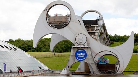
Image caption, Falkirk Wheel
The Falkirk Wheel is the world's only rotating boat lift. It joins the Forth and Clyde canal with the Union canal. The 115ft structure is a tourist attraction in its own right and has over 500,000 visitors a year. (AlanWrigley / Alamy Stock Photo)
1 of 5
The Antonine Wall
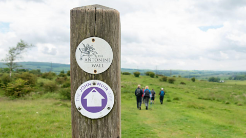
The Antonine Wall is a Roman fortification that marked the edge of the Roman Empire.
It was built along a very similar route to the Forth and Clyde Canal, between Bo'ness on the River Forth and Old Kilpatrick on the River Clyde, and for the same reason - this is where Scotland is narrowest from east to west, meaning the canal and the wall could be as short as possible.
Built by the three Roman legions stationed in Scotland, the Antonine Wall is now a World Heritage Site and a popular tourist attraction.
Try these Bitesize articles to learn more about the Antonine Wall and the Romans in Scotland.
Transport networks
Transport networks keep places connected and allow people and goods to move around the country.
Scotland's canals are just one of Scotland's transport networks.
Rail network
Scotland's railways were built to carry passengers and goods. They could do this much more quickly than canals.
There are more than 2,700 kms of railway line connecting 359 stations, as well as linking Scotland to England.
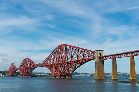
Scotland's rail network includes 4,715 bridges from small arches crossing single roads or rivers, to the two and a half kilometre long Forth Rail Bridge.
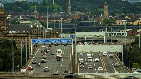
Road network
There are more than 3,500 km of trunk roads and motorways connecting Scotland's cities, towns, ports and airports. These roads provide the country's main transport for people and goods.
In areas with less traffic, some of these main roads are single carriageway. Where there is lots of traffic, motorways can be much wider. When it crosses the Kingston Bridge in Glasgow, the M8 motorway has five lanes of traffic going in each direction.
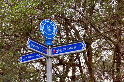
Cycle network
The National Cycle Network is a collection of cycle paths, shared use paths and roads connecting towns, cities and places of interest all round the UK.
There is over 1,643 miles of National Cycle Network routes in Scotland, with over 700 miles of traffic free routes. The network makes use of parts of Scotland's other networks, with routes along canal towpaths, and disused railway lines like the Deeside Way between Aberdeen and Ballater.
Key words
Check your connection, refresh the page and try again. - A canal lock is used to allow boats to move between parts of a canal that are at different heights. A lock holds water between two gates. Water can be allowed in or drained out to change the water level so that boats can be raised or lowered.
Check your connection, refresh the page and try again. - A path along the side of a canal or river. Horses or vehicles could move along the path, towing boats along behind them.
Check your connection, refresh the page and try again. - A valley that runs from Fort William to Inverness. The Great Glen separates the northwest Highlands and the Grampian mountains.
Check your connection, refresh the page and try again. - A small steam-powered boat that carried goods and supplies between Scotland's west coast and islands, and Glasgow and the surrounding area
Check your connection, refresh the page and try again. - Products that are transported to be bought or sold.
Test your knowledge
More on Landscapes
Find out more by working through a topic
- count9 of 25
- count10 of 25
- count11 of 25