Case study - The Curly Burn
The best way to understand how local rivers work is to get out and see for yourself. The Curly Burn river in Limavady is a great example.
There are six accessible stops to collect river data along the Curly Burn: Grange Park wood, Largantea picnic site, Metal Bridge, Lady O’Cahan’s bridge, Bolea, and Streeve.
Grange Park Wood
Grange Park Wood is located 0.88 kilometres from the source in the upper section of the Curly Burn. It mostly contains basalt and is surrounded by upland coniferous forestry containing coniferous trees.
Over the years, humans have created drainage channels for the forest and have cleared very large boulders from the river channel. The area has also been reforested.
The channel at this point of the river has been cleared, widened, straightened and deepened.
The nearby trees provide interception, affecting the depth of the river. Interception in this context refers to precipitation that is intercepted by the leaves, branches or plants and the forest floor and therefore does not reach the soil.
Since large boulders have been removed from the channel, the bedload size is affected by human interference. As a result, the friction between rocks has been reduced due to the removal of the large bedload, increasing the velocity at this point of the river.
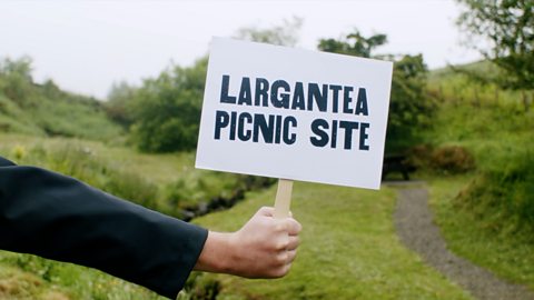
Largantea picnic site
Just over a kilometre downstream from Grange Park Wood is Largantea picnic site, which is in the upper section of the river and 1.95 kilometres from its source.
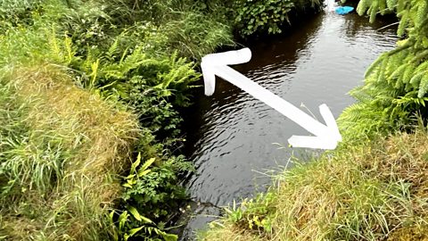
Like Grange Park wood, its rock type is basalt and it contains forestry. The land is used for recreational purposes and has a steep valley side, where the river meanders. A meander is an extreme U-turn of a stream as it moves through a landscape.
There is lots of evidence of recent flooding with very small pieces of bedload deposited on the banks of the Curly Burn at this point.
Near the sampling site exists a small waterfall with a plunge pool and gorge, which is a narrow valley commonly found between hills or mountains, typically with a river or stream running through it.
You can find evidence of erosion on the outside of the meanders. River managers had to take bedload from this point of the river and build up a temporary small wall to stop erosion of the meanders. The larger bedload size here creates more friction, which reduces the river’s velocity.
Metal Bridge
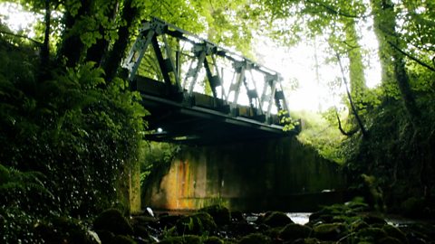
Further from the source is the middle course of the Curly Burn. The Metal Bridge site, like the other sites mentioned so far, has a basalt rock type.
Pastoral farming and grazing, mainly from cows is the typical use of the land around the site.
Under the bridge, the downstream bed and banks have been replaced with concrete, reducing friction to a minimum and therefore increasing the velocity.
Like at Grange Park Wood, river managers have cleared away the large bedload from the middle of the channel. The width of the river at Metal Bridge is approximately 8 meters in places, but it is not very deep because of the interference of replacing the natural bed and banks.
It would be better to sample the bedload and depth upstream where the river is in a more natural state.
Lady O’Cahan’s bridge
Four and a half kilometres from the Curly Burn’s source is Lady O’Cahan’s bridge. Right in the middle of the river, the rock type of this section changes from basalt to a mixture of limestone, chalk, flint and some basalt.
The land on the other side of Lady O’Cahan’s bridge is flat, suitable for some arable farming to take place. This part of the river has not had too much human interference, however, there is a worn-out path along the river.
It may be difficult to sample the river, because Lady O’Cahan’s bridge section has a very steep bank.
A major confluence sits just upstream from the bridge, which indicates that the river has doubled in size. A confluence is the point at which rivers or streams join thereby increasing the volume of the river.
There are only a few big boulders left in the channel at this point of the river. Due to this tributary, the depth increases, bringing water to the channel, increasing the width and thereby the amount of erosion.
The velocity also increases due to the lack of boulders in the channel. Erosion happens more quickly as limestone dissolves at a faster rate than the other rocks present in the Curly Burn. Flint, for example, will not erode.
Bolea

The Bolea site is 6.70 kilometres from the Curly Burn’s source. It has the same rock types with the addition of mudstone.
There are more people living alongside the river at this section, as well as farmland and a sewage treatment works.
Bolea is on a meander, because of which, a farmer has used natural materials from the river to build a wall to protect his land. On the inside of the meander exists a slip-off slope, which is a gently sloping bank found on the inside of a river bend. The slow-flowing water and depositing causes the formation of the slope.
As a river goes around a bend, most of the water is pushed towards the outside, causing increased erosion. As a result, larger rocks are deposited upstream and the smaller rocks at the far end of the slip-off slope. The wall stops the natural process of erosion.
While the slip-off slope continues the process of deposition on the inside of the bend, the erosion on the outside has been stopped by the wall. Much like the limestone in the Lady O’Cahan’s Bridge site, the mudstone, combined with limestone, erodes easily and therefore creates a more rounded bedload.
The basalt by this stage of the river has travelled a long way, becoming smaller and more rounded.
Streeve
Near the end of the river, the Streeve site is located at the lower section of the Curly Burn. Sandstone, basalt, chalk, limestone and flint can be found here.
On one bank, there is abandoned agricultural land belonging to a country estate. Once arable farmland, the land now provides interception and there’s not much evidence of human interference along this part of the river.
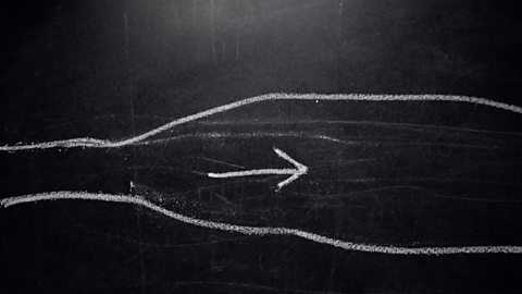
The channel is braided which means there exists multiple channels and islands of sediment between those channels. The velocity is at its highest rate at the Steeve section as there are no boulders or large stones so there is little to no fiction.
Test yourself
More on Rivers and Water
Find out more by working through a topic
- count2 of 4
- count3 of 4
- count4 of 4
