Case study - river landforms: River Tees
The River Tees is located in the north of England. The The place where a river starts in its upper course. of the River Tees is located in the Pennines and it flows east to its The place where a river meets the sea. where the river joins the North Sea.
Upper course
- The The highest section of a river located in the mountains. has hard impermeable rocks. Here, When the land is eroded or worn away in a downwards direction, eg a river that is high up will erode vertically because gravity pulls the water downwards. has formed a V-shaped valley.
- High Force, the UK's largest A steep drop in a river. at 21 metres high, is located in the upper course. An area of hard rock, called Whin Sill (or Whinstone), is located above a layer of soft rocks (sandstone and shale) and together they create this impressive waterfall.
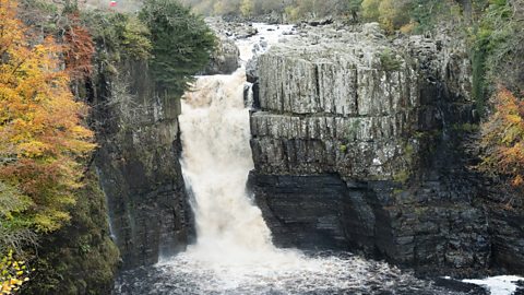
High Force waterfall
Middle course
- As the River Tees starts to erode sideways (The wearing away of the landscape when a river erodes sideways.), it forms A bend in a river.. These can be identified in the The middle section of a river which has sloping land. near Barnard Castle.
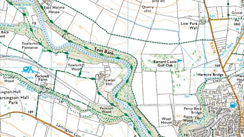
© Crown copyright and database rights 2015 Ordnance Survey
Lower course
- Near Yarm, the meanders in the The final section of a river located on flat land. are much larger, and a curved lake formed from a horseshoe bend in a river where the main stream has cut across the narrow end and no longer flows around the loop of the bend. have formed. In this area there are also Ridges or banks formed by deposits of alluvium left behind by the periodic flooding of rivers. Can also be artificially constructed banks or walls. which have formed when the river has flooded.
- The River Tees has a very large The open mouth of the river where it meets the sea. with mudflats and sandbanks which supports wildlife in the area. Sites such as Seal Sands are protected areas.
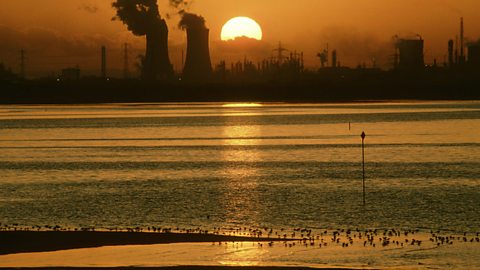
The River Tees estuary and its mudflats
More guides on this topic
- Coastal processes - Edexcel
- Coastal landforms - erosional and depositional processes - Edexcel
- Human activities on coastal management - Edexcel
- River processes - Edexcel
- Human management of rivers - Edexcel
- UK landscapes - Edexcel
- How do glacial processes form the land? - Edexcel
- Human activities and glaciation - Edexcel