What do you know?
What are cities?
Cities are built-up areas. They have many buildings and lots of people. Cities can also be called urban areas.
Key points
- Cities in Countries recognised by the World Bank as being wealthier. This classification is reviewed yearly. have grown over a long period of time. The growth of HIC cities has been mapped out using land-use models, such as the Hoyt (or Sector) Model.
- Cities in HICs grew during and after the A period of time during the 18th century where the population of some countries changed from rural, farming communities into urban, industrial communities based around the use of machines.. Population growth in HIC cities is now lower and some are even experiencing population decline.
- Cities in HICs grew outwards along Transport links, such as roads and railways, that run from the city centre outwards.. The oldest parts of a city are found in the centre.
What are cities in HICs like?
Countries recognised by the World Bank as being wealthier. This classification is reviewed yearly. are those recognised by the World Bank as being wealthier. Cities in HICs are often When something has existed for a long period of time and is functioning successfully. and have grown over a long period of time. Some have existed since the Roman times. Many cities in HICs developed around a specific The purpose of something, for example a city may have grown around its port or the river., for example a A harbour where ships can load and unload. . They typically contain Recognisable structures and features of a city that have existed for a very long time, eg city walls or a cathedral., businesses, shopping areas and a variety of housing types.
The Hoyt Model
The layout of HIC cities are represented using Diagrams that show the typical patterns of how land is used in a city.. The A diagram that shows the typical layout of a city in a HIC. was mapped out in 1939. It shows a basic pattern:
- The The middle of a large town or city where businesses, like offices and shops, are located. in the middle. Land values in the CBD are high, so the most Something that makes a lot of money, for example shops in city centres are profitable. shops and businesses locate here.
- Buildings where products are made to sell. For example, a car factory assembles cars. and Often refers to factories, but can mean any form of employment that makes money. develop along transport routes.
- Low-cost housing lies close to the CBD (where plot sizes are small) and beside the industry.
- More expensive housing lies further away, where larger plot sizes allow space for gardens and garages.
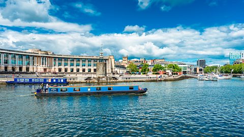
Whilst the Hoyt Model shows general trends, it is largely outdated. For example, more expensive housing is now found inWhen something is changed to make it better or more up-to-date, eg a disused factory may be redeveloped into new housing. industrial areas of HIC cities, for example the harbourside area of Bristol.
Question
How accurate is the Hoyt Model today?
The Hoyt Model was mapped out in 1939 so it was based on cities in HICs a long time ago. New expensive housing developments have taken place close to the central business district, for example, the redevelopment of old industrial sites in inner-city sites. In addition to this, the model shows general trends so is too basic. It is not possible for all cities to follow this same pattern.
How have HIC cities developed over time?
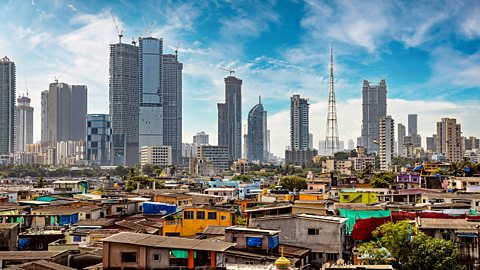
HICs are When somewhere becomes more urban. This means a greater percentage of people live in city areas rather than the countryside.. This means they have a greater percentage of people living in urban than rural areas. HIC cities are located around the globe. Examples include New York in the USA, Montevideo in Uruguay, London in the UK, Seoul in the Republic of Korea, and Sydney in Australia.
History of HIC city growth
The The movement of enslaved African people across the Atlantic Ocean. African slaves were forced to work on plantations. took place between the 1500s and 1800s. European A country that uses its power to control another country. For example, Great Britain was a colonial power that ruled the British Empire. When people are forced to work for nothing. Enslaved people were seen as property. African people and forced them to work on A large piece of land on which crops are grown. During the transatlantic slave trade, plantations were used to grow coffee, sugar and tobacco.. Profits from slavery allowed A harbour where ships can load and unload. cities like London, Bristol, Glasgow, and Liverpool, to grow and become wealthier. Find out more about the transatlantic slave trade here.
Many believe that the wealth from slavery enabled the A period of time during the 18th century where the population of some countries changed from rural, farming communities into urban, industrial communities based around the use of machines.to take place. Cities in HICs grew during and after the Industrial Revolution. People moved from the countryside to cities looking for work in factories.
Lots of people now work in offices or When an employee carries out their job away from their office. This often means that they work from home or from their usual place of work.. Office and remote working can take place anywhere and so people do not have to live in cities. When the number of people living in an area increases. in HIC cities is now lower and some are even experiencing When the number of people living in an area decreases..
Patterns of HIC city growth
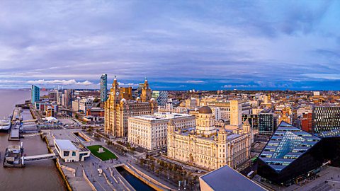
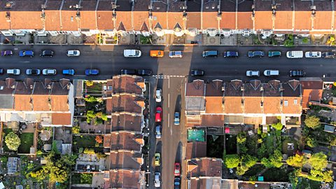
Cities in HICs grew outwards, with the oldest parts of the city found in the centre. Historic structures, like city walls and cathedrals, are found here. Cities grew outwards along Transport links, such as roads and railways, that run from the city centre outwards. that led into the surrounding countryside. As more buildings were When something is built, for example a house or an office block., space in the centre became limited and land values increased. The high cost of land led to developers building upwards, and so taller buildings and A very tall building found in some city centre locations. are often located in city centres.
Question
Why did cities in HICs grow?
Cities in HICs grew during and after the Industrial Revolution. People moved to the cities looking for work.
Game - What is urbanisation?
Play a Planet Planners mission to help people thrive in a rapidly urbanising world.
You can also play the full game
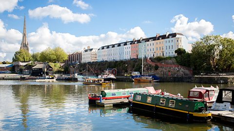
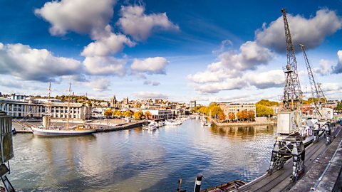
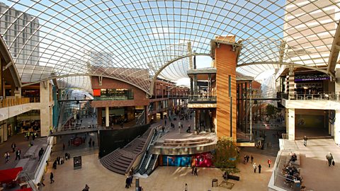
Case study: Bristol over time
Look at the slideshow below to learn about how Bristol, in England, has developed over time.
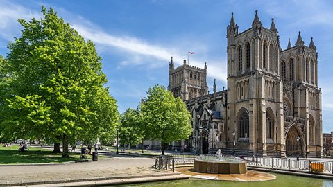
Image caption, The oldest parts of Bristol are found in the centre. Historic structures, like the castle, city walls and cathedral are found here. These date back to the 11th century.
1 of 6
Test your knowledge
Quiz
Play the Planet Planners game! game
Make decisions for the planet in this KS3 geography game.

More on Urbanisation
Find out more by working through a topic
- count2 of 4

- count3 of 4

- count4 of 4