Colder weather and snow for the UK but where?
- Published

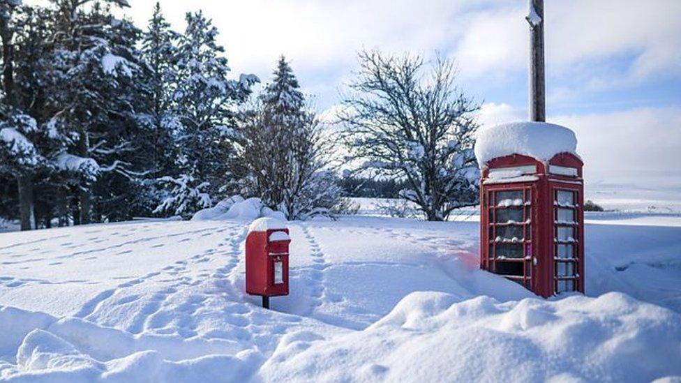
Heavy snow especially over high ground could cause some disruption on Thursday
Colder weather is spreading across the United Kingdom with a return of wintry conditions for many.
Snow and ice warnings have been issued by the Met Office initially across Scotland but more widely across the UK into Thursday and Friday.
With the potential for significant snow over high ground, some disruption is likely.
But there is still some uncertainty about how much snow could fall to lower levels.
Forecasting snow in the UK can be very challenging and that is certainly the case this week as milder, wetter conditions spread north-east from Wednesday night.
As it meets colder air from the north we could see snow falling. Even the most advanced weather computer models struggle with the detail of where and how much could fall.

The battle between cold and mild air brings the threat of snow on the boundary between the two
What we know
The area where rain is likely to turn to sleet and snow is across mid- and north Wales, the north Midlands, northern England, southern Scotland and Northern Ireland.
The Met Office has a broad yellow warning for snow covering these areas from 06:00 on Thursday to 06:00 on Friday.
We will see snow falling over the hills and mountains above 400m (1,300ft), where there could be as much as 15-25cm (6-10in) of accumulating snow and ice.
Communities and roads around Eryri - formerly known as Snowdonia - the Pennines and Scotland's Southern Uplands will see some disruption through Thursday which could last into Friday as well. The warning says there is a small chance that rural communities could be cut off and there could be power cuts and travel delays.
Any locations that are around 200-400m (650-1,300ft) above sea level also have the potential for some disruption with 2-5cm (1-2in) of snow accumulating.
Down to lower levels with mild air in the mix, there may only be sleet or a light covering of snow.
What we don't know
There are many variables over small areas or distances that will determine whether rain turns to sleet or rain.
Half a degree Celsius or the rate of precipitation will make all the difference over time and area in marginal situations like this.
We are still a couple of days away and the only computer models available to help forecasters at this time are low resolution. The higher resolution models which contain more detail on terrain and weather components will kick in nearer the time.
If you have heard or seen reports claiming to give precise detail of where and when heavy snow will be, many days in advance, they will be stretching the capabilities of forecasting.

In these weather situations you can often get a complicated mixture of rain, sleet or snow
Why is my app showing a different forecast?
You may be living in the area where there is a yellow warning in force for snow but the app or website you use is showing either that it is raining or sleet.
This is because of the difficulties in forecasting snow in marginal situations. Apps and websites often use raw data that has no or limited intervention by a meteorologist.
They also automatically update based on real-time observations and that is why it can sometimes feel like the forecast is changing all the time.
In reality, the forecast should actually be improving all the time as more useful data comes in.
Apps are a useful tool to help you make decisions on the weather but as meteorology is a complicated science, there is still the need for humans to interpret, highlight and communicate those complexities.
Keep up with our latest thoughts on the forecast online, on and on .
- Published26 November 2023
- Published17 January
