How does Milton compare with Helene and other hurricanes?

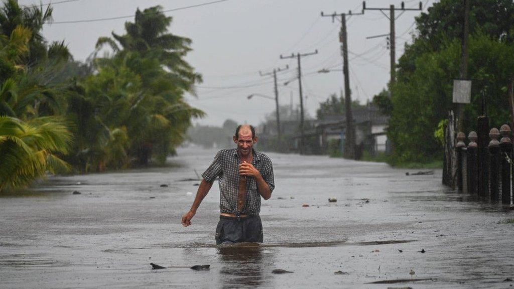
Hurricane Helene left a trail of devastation at the end of September
- Published
Following the widespread devastation that Hurricane Helene brought to the south-east of the US last month, there will be a great deal of anxiety around Hurricane Milton.
But the two hurricanes will have some significant differences, meaning their impacts are also likely to be different.
The vast majority of fatalities from hurricanes comes from water hazards, not the wind.
Flooding from torrential rain and storm surges along with rip currents and marine accidents account for nearly 90% of those killed in hurricanes.

Hurricane Helene caused severe flooding as far inland as Atlanta, Georgia
How will the storm surge compare?
Hurricane Milton is forecast to bring a storm surge of up to 15ft (4.5m) along the west coast of Florida. The exact path the hurricane takes will be crucial for at-risk coastal communities. The largest surge will be to the south of the centre of the hurricane.
If Milton makes landfall to the north of Tampa, then some of the biggest surges could go into the highly populated Tampa Bay area. So, the storm surge from Milton could end up giving greater coastal flooding impacts - there is still some uncertainty.
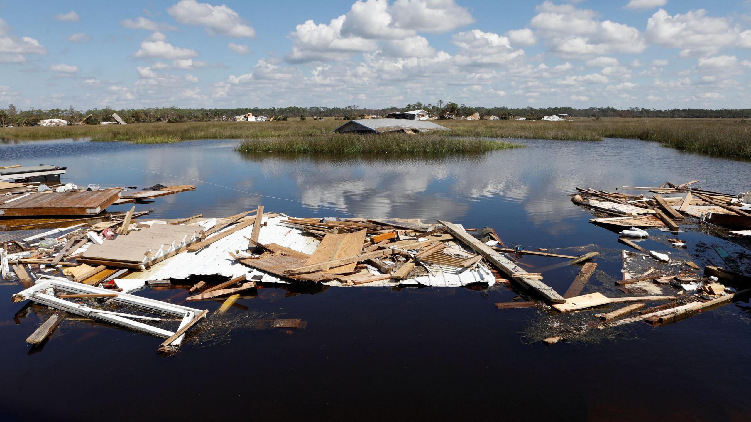
Hurricane Helene made landfall in the Big Bend coastal region of north-west Florida with a storm surge reported at over 15ft. This area of Florida has a relatively low population density.
However, as Helene was so big, there was also a storm surge down along the Florida coast to Tampa Bay.
At this time, the surge of 7.8ft (2.4m) became the highest on record for Tampa.
With the US National Hurricane Center forecasting a storm surge of 10-15ft (3-5m) for Tampa Bay during Hurricane Milton, this record is very likely to be exceeded.
- Published2 days ago
How much rainfall will there be?
After making landfall at 11:25pm local time on 26 September, Helene weakened and its remnants stalled across the Appalachian mountains and Tennessee Valley.
Enormous rainfall totals built up, with 30.78in (782mm) recorded at Busick, North Carolina. This extreme rain resulted in catastrophic flooding and landslides.
In contrast, Hurricane Milton will move quickly across Florida resulting in up to 18in (460mm) of rain, which is still enough to cause some severe flooding, but unlikely to be as extreme as the flooding from Helene.

The paths of Hurricane Milton and Helene, both hitting Florida within weeks of each other
Will the wind strength be similar?
Hurricane Helene was a Category 4 hurricane with sustained winds of 140mph (225km/h) and was at its peak strength when it made landfall.
At its peak, Hurricane Milton was even stronger with sustained winds around 180mph (290km/h) - a top rated Category 5 hurricane.
It will weaken slightly before landfall, becoming a Category 4 with wind speeds in excess of 130mph (210km/h) with gusts higher.
Perhaps the wind damage will end up being similar from both hurricanes, with Milton's marginally less strong winds being offset by those winds affecting a more populous area of Florida. Either way, widespread damage and disruption is likely.

Hurricane Katrina was a Category 5 hurricane in the Gulf of Mexico hours before making landfall in New Orleans
How does Milton compare to Hurricane Katrina?
Hurricane Katrina made landfall near New Orleans in August 2005 as a Category 3 and was at the time the strongest and most destructive hurricane to hit the US, killing around 1,300 people.
However, before landfall and just like Helene only two weeks ago, Katrina was a more powerful Category 5 hurricane in the hours before landfall.
While Katrina, Helene and now Milton have taken different paths and making landfall in different areas, there is one big similarity.
They all underwent rapid intensification in the warm waters of the Gulf of Mexico and headed towards the US coast.
If atmospheric conditions are right, with sea surfaces temperatures higher than 27 Celsius, tropical cyclones here can develop quickly.
Over the last month the Gulf of Mexico has had record heat content with sea surface temperatures at 29-31C.
This is like rocket fuel for hurricanes, supercharging them into the Category 5 storms Helene and Milton became.
shows that at least 40 storms in the Atlantic have reached Category 5 status since 1924, though only four have actually hit land at that strength. Here are some of the most damaging:
Hurricane Camille
Camille crashed into Mississippi in 1969, producing a peak storm surge of 24ft (7.3m) and destroying almost everything along the coast.
It killed 259 people, most of them in Virginia, and caused about $1.4bn in damage.
Hurricane Andrew
Andrew decimated southern Florida in 1992 with sustained wind speeds of up to 165mph (266km/h) and gusts as high as 174mph (280km/h).
It claimed 26 lives directly and was blamed for dozens of other deaths. After causing $30bn in damage, it was considered the costliest natural disaster in US history at the time.
Hurricane Michael
Michael slammed into Florida in 2018 with 160mph (260km/h) wind speeds and was the strongest storm to make landfall in the Sunshine State.
At least 74 deaths were attributed to the storm - 59 in the US and 15 in Central America - and Michael caused an estimated $25.1bn in damage.
- Published2 days ago
- Published2 days ago