Is the heatwave almost over?

Many people have flocked to the coast this week where it has been a little cooler, as seen here in St Ives, Cornwall
- Published
It has been a hot, humid week across the southern half of the UK.
Several places in central and southern England and Wales recorded at least four consecutive days of heatwave conditions – where temperature exceeded the region’s heatwave criteria.
The hottest day of the year so far was on Tuesday in London, where 32C was recorded. The place that has seen the longest run of hot weather is East Malling in Kent, where Friday could mark the sixth day of the heatwave.
Will there be more thunderstorms?
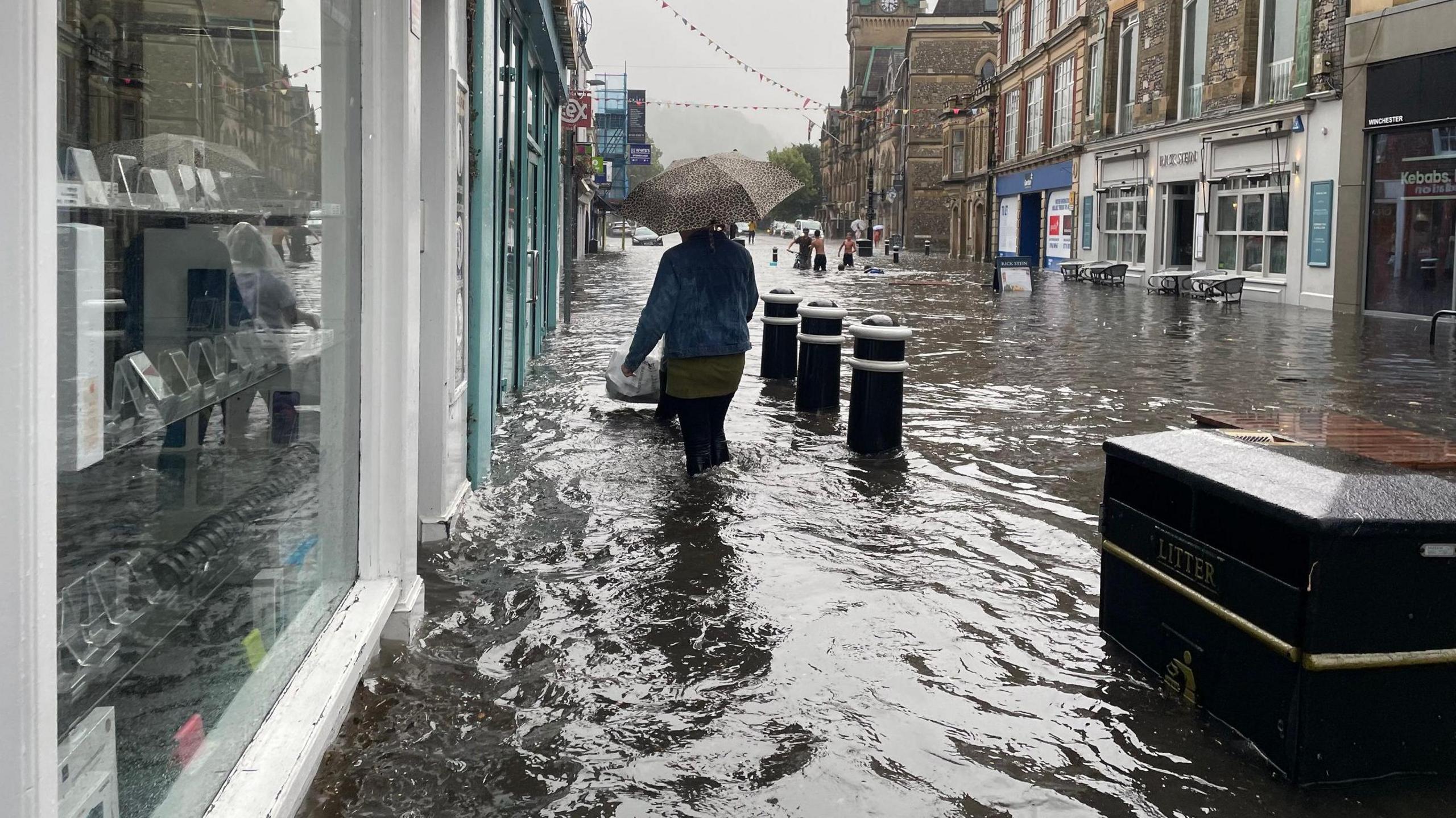
Summer heatwaves can help fuel powerful thunderstorms, as we saw on Thursday in parts of central and southern England and Wales.
Some places in Hampshire and Surrey saw around 45mm of rain in just a few hours - around three quarters of the expected rainfall for the whole of August. This led to localised flash flooding and power cuts.
For now, the risk of thunderstorms has subsided as high pressure has moved in, so for most we are not expecting stormy conditions for the next few days. However, there is a small chance of the odd thunderstorm in southern England on Saturday afternoon.

The weekend forecast shows a mixed bag of weather across the UK
What will the weekend bring?
A gradual reduction in heat and humidity is on the way this weekend, as a frontal system pushes slowly south-eastwards. Maximum temperatures will range between 15C and 24C by day, with a return to more comfortable conditions overnight too.
Saturday: Showery rain will affect parts of central, southern and eastern England at times. There will also be blustery showers moving into western Scotland and Northern Ireland later on. Elsewhere should stay dry with long spells of sunshine.
Sunday: Most places will be dry and fine for much of the day, but cloud and rain will arrive across Northern Ireland and western Scotland late in the afternoon.

Typical pressure and fronts - next week
Further ahead
Next week looks a little cooler and more unsettled in general.
Areas of low pressure will move in from the north-west, leading to spells of wet and windy weather at times, especially for Northern Ireland and Scotland.
Higher pressure will influence the weather further south, so there should be a good deal of drier weather for southern England and Wales, although some rain is likely, especially on Tuesday.
Keep up to date with your local forecast at Â鶹ԼĹÄ Weather online and via the app or, for a look further ahead, read our monthly outlook.
- Published1 August
- Published1 August

- Published17 May 2023


