Warmer weather on the way as Arctic air retreats

Our chilly spell is coming to an end and temperatures are set to rise
- Published
Thursday night brought parts of the UK their first air frost of the season - and even a glimpse of the Northern Lights for some.
A feed of northerly winds - a so-called Arctic blast - has brought below-average temperatures this week and a dusting of snow over the highest mountains in northern Scotland.
But before you abandon the warm weather clothes and dig out the winter woolies, it is worth remembering that the atmosphere can be fickle.
Sure enough, it is going to turn warmer over the weekend - and next week some places could reach 25C.
How cold has it been?
Over the last couple of days we have been recording daytime temperatures two or three degrees below the September norm.
Downpours have peppered the UK bringing rain, hail, thunder and a dusting of snow over some mountain tops in Scotland - not unusual for the meteorological autumn.
The nights have been cold too. Topcliffe in North Yorkshire saw a low of -2.7C on Friday morning giving England its earliest air frost in five years. Wales and Northern Ireland also had their earliest frosts in several years.

It was a frosty Friday morning in Leeds
Warming up over the weekend
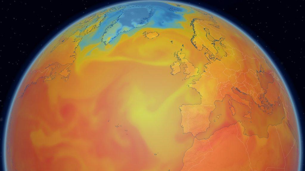
The feel of the weather depends largely upon where the air has come from.
And over the last few days the source of the air has been the Arctic, with cold north-westerly winds feeding southwards across the country. The strength of those winds has only exacerbated the chilly feel.
But as high pressure builds to the south of the UK and low pressure moves to the north-west, our wind direction is switching to a south-westerly, bringing warmer air from the Atlantic.

Cold north-westerly winds will be replaced by warmer south-westerlies
Highs of 14 to 20C are expected across the country this weekend - around the seasonal average - and the nights will become milder too.
It won't be completely dry though. A frontal system will bring cloud and some rain, especially towards the north and west of the UK although very little wet weather is likely in the south-east of England.
Will I see the Northern Lights?
Thursday night offered some places a chance to see the aurora borealis - the Northern Lights.
Space weather forecasters suggest Friday night - especially after midnight - may offer another chance, although the aurora is expected to be slightly weaker overall and mostly confined to the north of the UK.
Unfortunately these northern areas are likely to be affected by large areas of cloud which could obscure any views.

This was the spectacular view of the aurora from Aberdeenshire on Thursday night
Even if the skies do clear, the aurora is unlikely to be visible with the naked eye away from northern Scotland. A phone or long-exposure camera may be needed to catch a glimpse.
A return to summer?
Early next week high pressure is set to build more strongly and as it drifts northwards an easterly wind will develop.
This will see temperatures climbing even further, widely reaching 19-21C across Scotland and Northern Ireland, with 22-25C likely in parts of England and Wales by midweek.
While this might not technically be a return to summer it will certainly be a big change in the feel of the autumn weather.
And - while computer model output can change - at the moment there is no strong signal that widespread cold northerly winds will return before the end of the month.
You can always keep up to date with forecast details for your area online.
- Published1 day ago
- Published16 September 2019
- Published2 September