Multiple warnings issued for more rain after week of flooding

- Published
More rain is set to sweep across much of the UK later on Sunday, after some parts of southern England saw up to four times September's average rainfall during the week.
Strong winds are also expected, with several Met Office yellow weather warnings issued for both rain and wind.
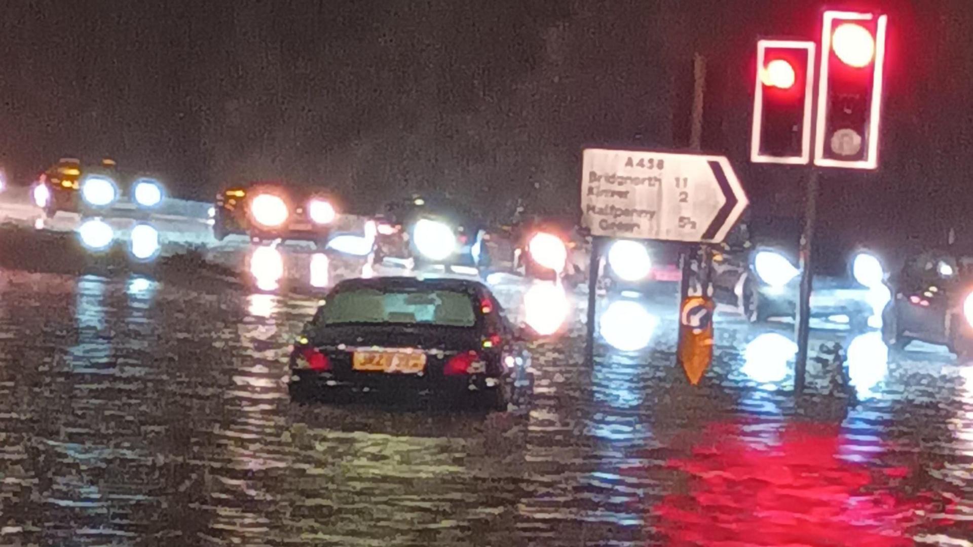
The wet and windy weather may bring further flooding and travel disruption into Monday and Tuesday.
Met Office issues yellow warnings for rain

Areas covered by Met Office yellow warnings for rain between Sunday and Tuesday
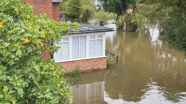
Despite a break from the rain on Saturday and parts of Sunday, the ground remains very saturated and river levels are high in parts of England and Wales.
Three to four month's worth of rain has fallen in parts of Bedfordshire, Oxfordshire, Hampshire and Herefordshire already this September.
Therefore even a relatively small amount more over the next two days could lead to localised flooding which could have an impact on property and disrupt travel in some areas.
There are currently a number of but given the drier weather this weekend that number is lower than at times in the past week. It is possible it could rise again following the forecast rain.

Flooded fields at Woodstock, Oxfordshire, on Saturday
Rain will move in from the south-west during Sunday and spread further into Wales and central southern England by the end of the day.
It is not expected to be as intense as that seen over the last week. However, with around an inch (25mm) of rain possible for many within the warning areas, there could be some impacts.
One Met Office yellow warning for rain, valid from 1600BST Sunday to 0900BST Monday, states that there could be more three inches (80mm) of rain on some hills in the south-west of England and south Wales.
Heavy rain will then spread to other areas of England and Wales during Monday, prompting the Met Office to issue further yellow warnings in parts of north-east Wales, north-west England, the Midlands, Yorkshire, Lincolnshire and Norfolk. More than three inches (80mm) is possible on higher ground in these areas too.
The most persistent rain could last into Tuesday, especially in parts of Yorkshire, Lincolnshire and the East Midlands, adding to flooding concerns.
Strong wind warning issued for Sunday

The Met Office has issued a yellow warning for wind on Sunday
Strong winds will accompany the area of low pressure and rain as it moves in through Sunday.
Much of west and south Wales, and south-west England will experience the strongest gusts.
A Met Office yellow warning for wind has been issued from 09:00 to 23:59 BST on Sunday.
Gusts of 50-55mph (80-89km/h) are expected quite widely with some exposed areas potentially seeing gusts in excess of 60mph (97km/h).
Coastal areas may see large waves and water overtopping with some disruption to transport networks.
When will the rain stop?
The low pressure - responsible for the wet and windy weather - will start to retreat to the east throughout Tuesday and Wednesday, although strong winds may persist in eastern England.
We should then have a few days of quieter weather with little rain in the forecast, but some chilly night with the chance of frost and fog for a few.
By the weekend low pressure is likely to return bringing more rain and strong winds to parts of the UK.
Read our latest thoughts on the longer-term forecast with our monthly outlook.

- Published27 September
- Published27 September