Learning from the Japanese earthquake
What we’ve learnt about earthquakes and tsunamis in the two years since the magnitude 9, 2011 Tohoku quake in Japan. Roland Pease talks to experts studying the region.
On 11 March 2011, at 05:46 Universal Time, a magnitude 9.0 earthquake struck off the north-east coast of Japan. The Tohoku quake caused a tsunami that reached land elevations higher than 38 metres above sea level. Over 15,800 people died and more than 3000 are still missing.
Two years on, we look back and ask how more people could have been saved? Bob Geller, Seth Stein and Greg Beroza give their views on whether earthquake hazard maps should be used as a tool to determine where people should live. Costas Synolakis has used eyewitness videos from survivors to find out for the first time how quickly the wave moved over land, giving us vital data to develop more resistant roads and better warning systems.
And we take a look at the technology that may increase the notice given to local people, which is so vital for saving lives. Real time GPS systems offer hope here. More widely, detail of how a particular tsunami will behave as it crosses the ocean to distant coastlines is almost impossible to know, so warnings of the wave’s height or arrival time cannot be given to residents living on further shores. But Giovanni Occhipinti explains that watching the wave’s effect on the sky high above the water could eventually tell us this information, allowing even more people to successfully escape. But the problems for earthquake science, and for Japan, are still far from resolution.
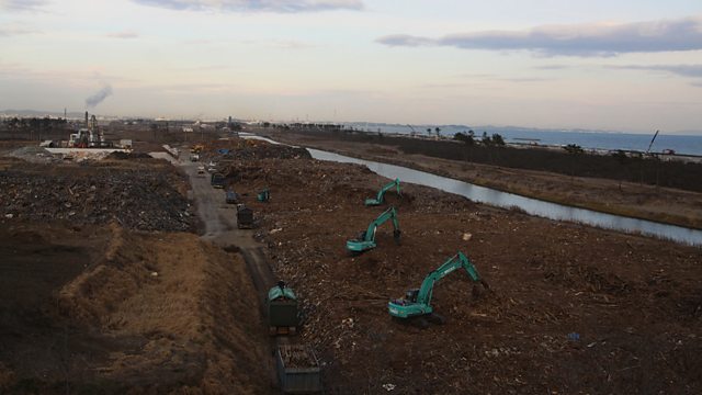
(Image: The clean-up operation on Honshu’s coast continues. Credit: Paul Donald, Dec 2012.)
Last on
More episodes
Previous
Next
Broadcasts
- Thu 7 Mar 2013 19:32GMTΒι¶ΉΤΌΕΔ World Service Online
- Fri 8 Mar 2013 00:32GMTΒι¶ΉΤΌΕΔ World Service Online
- Fri 8 Mar 2013 04:32GMTΒι¶ΉΤΌΕΔ World Service Online
- Fri 8 Mar 2013 11:32GMTΒι¶ΉΤΌΕΔ World Service Online
Podcast
-
![]()
Science In Action
The Βι¶ΉΤΌΕΔ brings you all the week's science news.


